Sustainable Humanitarian Settlements
This Humanitarian Planning Hub project on Sustainable Humanitarian Settlements is a cooperation with the external page Geneva Technical Hub, a joint initiative of the external page UN refugee agency (UNHCR) and the external page Swiss Agency for Development and Cooperation (SDC). The aim is to provide innovative technologies and technical expertise to tackle the manifold challenges faced by millions of displaced people worldwide. A particular focus lies in the greening of the blue and, therefore, reducing the environmental impact of humanitarian settlements. In the first phase and in close collaboration with the research group Planning Landscape and Urban Systems (PLUS), the project develops a user-friendly GIS tool to create participative risk mitigation strategies in refugee camps around the globe and a Catalog of Flood Risk Mitigation Measures to support the UNHCR field staff with a comprehensive overview of risk mitigation measures against flooding in humanitarian settlements.
Introduction
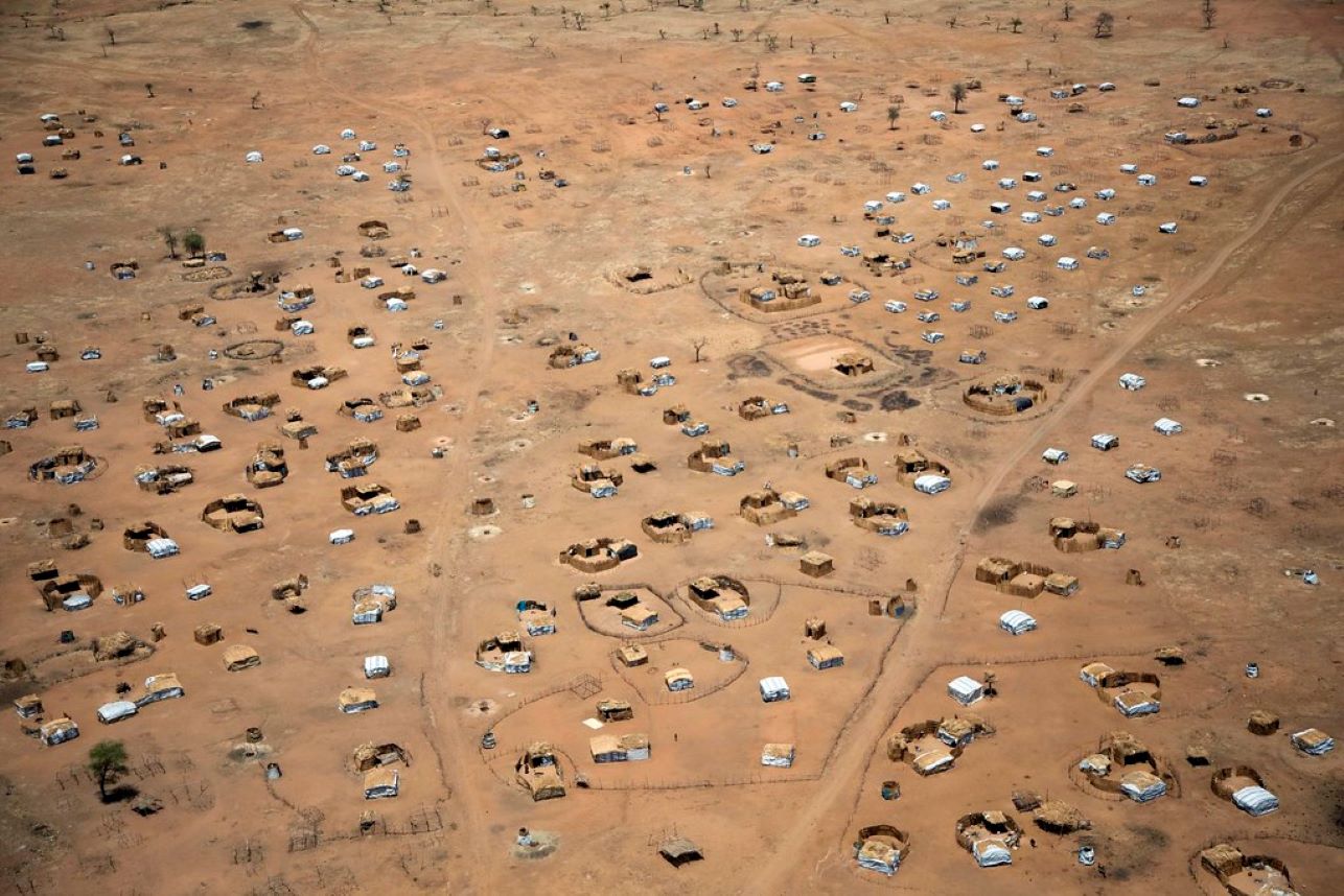
As of mid-2021, 84 million people worldwide were forcibly displaced from or within their country of origin (UNHCR, 2022). Displaced populations and humanitarian settlements are at high risk of suffering the consequences of climate change, sometimes leading to multiple displacements and loss of lives. At the same time, humanitarian actors, such as UNHCR, are urgently working towards decreasing the CO2 emissions of their humanitarian operations, especially in the field of humanitarian settlements.
The external page Geneva Technical Hub (GTH) has been established to improve the lives of refugees, internally displaced persons, and their host communities by tackling the environmental impact of humanitarian settlements and by supporting the resilience of displaced and host communities to climate-related hazard risks. Within this framework, GTH works closely with Swiss universities, including the ETH.
The Humanitarian Planning Hub of the SPUR research group contributes with its and ETH’s broader expertise to the general mission of UNCHR and the specific mission of the Geneva Technical Hub: To make humanitarian action and operations more sustainable. This collaboration focuses on natural hazard risk management and the environmental impact assessment of humanitarian settlements.
The Project
In the first phase of this project, the Humanitarian Planning Hub develops a user-friendly GIS tool to create participative risk mitigation strategies in refugee camps around the globe, focusing on flood hazards. This is based on the needs of refugee camps under the mandate of UNHCR. They lack the personnel and capacity to conduct an in-depth risk assessment and develop a risk mitigation strategy. Hence, the project aims to support field staff in identifying and mapping hazard and risks for a given settlement and provide them with general guidance on adequate mitigation measures.
The user-friendly tool (“Add-In”) for GIS software supports field staff in mapping and analyzing hazards in a given settlement and identifying adequate risk mitigation actions. The output of the tool is a risk mitigation strategy, including a risk map and a collection of proper risk mitigation actions. Besides the tool, the team develops a Catalog of Flood Risk Mitigation Measures. This catalog aims to support the UNHCR field staff with a comprehensive overview of risk mitigation measures against flooding in humanitarian settlements. Applied in parallel to the risk mitigation strategy tool (GIS Add-in), the catalog aims to identify and list globally applicable measures alongside design examples and good practices from local contexts.
In a second project phase, the Humanitarian Planning Hub will help create a practical tool for assessing the environmental impact of refugee settlements and providing possible sustainable interventions.
In this project, the humanitarian planning hub closely cooperates with the Chair of Planning Landscape and Urban Systems (PLUS).
Publications and Downloads
Catalog of Flood Risk Mitigation Measures (coming soon)
Risk Mitigation Strategy Tool for Arc GIS (coming soon)
Team Members
Project Director
Deputy head of Inst Spatial and Landscape Development / Head of Network City and Landscape ARCH and BAUG
Raumentwicklung und Stadtpolitik
Stefano-Franscini-Platz 5
8093
Zürich
Switzerland

Project Coordinator and Researcher
Raumentwicklung und Stadtpolitik
Stefano-Franscini-Platz 5
8093
Zürich
Switzerland
Project Coordinator
Raumentwicklung und Stadtpolitik
Stefano-Franscini-Platz 5
8093
Zürich
Switzerland

Researcher
Raumentwicklung und Stadtpolitik
Stefano-Franscini-Platz 5
8093
Zürich
Switzerland