New study on densification and displacement in the five largest Swiss agglomerations
In the study “Urban densification and displacement in Switzerland”, Fiona Kauer, Elena Lutz, Dominic Büttiker, and David Kaufmann, commissioned by the Federal Office for Housing (BWO), examine how residential construction activity in the five largest Swiss agglomerations - Basel, Bern, Geneva, Lausanne, and Zurich - contributes to densification and what social effects are associated with it.
The study is based on linked data sets from the Federal Statistical Office (FSO), including the Register of Buildings and Dwellings (RBD), the Buildings and Dwellings Statistics (BDS), the Population and Households Statistics (STATPOP) and the income data from the Central Compensation Office (CCO). By linking these databases, it was possible for the first time to quantify both the structural implementation of densification and the displacement of affected residents.
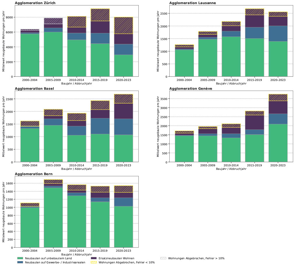
The study shows that inward development is implemented differently in
the core cities and in the municipalities in the wider agglomeration. While many new buildings are still being constructed on undeveloped land in peripheral municipalities after 2020, new replacement buildings, vertical extensions of buildings and the conversion of industrial and commercial space dominate in the core cities. In Basel, for example, around 15 percent of new residential buildings were built on former industrial and commercial zones between 2020 and 2023.
Despite a decline in the construction of new residential buildings, a net increase in dwellings is evident in most agglomerations, standing for all newly built dwellings minus the demolished dwellings. Geneva recorded an increase of 110 % between 2020 and 2023 compared to the period 2000-2004, while Zurich recorded a slight decline in newly built dwellings of 7 % per year.
The study quantifies for the first time how many people are displaced by
the demolition of dwellings or full renovation. In Zurich, over 14’000 people
(1.02% of the population) were affected between 2015 and 2020, compared to just 467 (0.08%) in Geneva. Households with low incomes, older people, asylum seekers, recognized refugees, and people of African descent are particularly affected.
The full article is available on open access external page here, or through the ETH Research Collection.
In addition, Prof. David Kaufmann gave an interview to ETH Zurich about the topic, which you can read here: “Vertical extensions of buildings are becoming a key option for urban redevelopment” | ETH Zurich